
Role of Watershed Management: Protecting Water and People
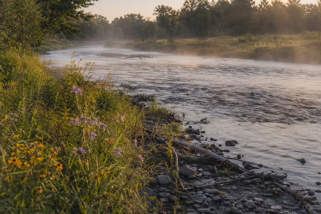
Watershed management coordinates land-use and water-use decisions across a drainage area so that the watershed keeps delivering clean water, flood protection, and healthy habitat instead of degrading under pressure. It works by treating an entire hydrological unit, not a single property or project site, as the unit of planning.
Environmental outcomes: cleaner water, intact habitat corridors, and natural flood buffering that reduces damage downstream.
Human benefits: lower drinking-water treatment costs, avoided disaster spending, and preserved recreation and cultural value.
Agencies including the EPA, the FAO, and university extension programs treat this coordination as a prerequisite for resilient land and water systems, not an optional add-on.
Key Takeaways
Watershed management works by coordinating land-use and water-use decisions across an entire drainage area, delivering measurable economic, public-health, and hazard-reduction benefits that engineered alternatives cannot match at the same cost.
Point | Details |
Scale defines the fix | Match interventions to whether you’re working at the yard, neighborhood, or basin level. |
Ecosystem services aren’t free | Filtration, flood storage, and habitat connectivity all require active protection to keep functioning. |
Prevention beats replacement | New York City, Tampa Bay, and Flagstaff all show protection costing less than post-damage recovery. |
Governance is the hard part | Fragmented jurisdiction across watershed boundaries causes more failures than missing technical solutions. |
Engagement is technical, not optional | Early stakeholder mapping and transparent goal-setting prevent plans from stalling later. |
Table of Contents
What Is a Watershed, and Why Does Scale Matter?
A watershed is the topographically defined land area that drains to a common point, whether that point is a storm drain, a creek, or a major river mouth. Rain falling anywhere inside that boundary eventually funnels toward the same outlet, carrying with it whatever the land surface picked up along the way: sediment, fertilizer, oil residue, or nothing at all if the ground cover is doing its job.
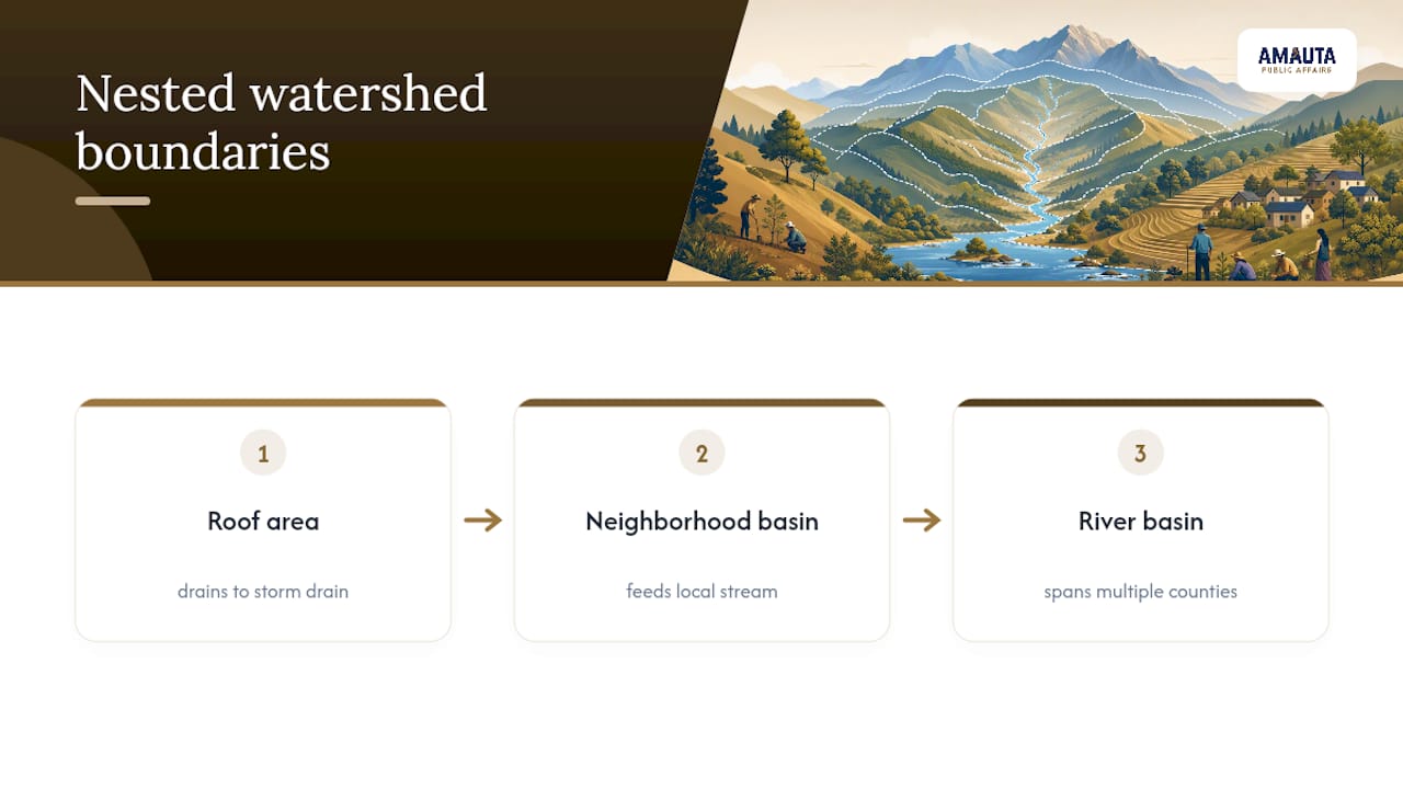
Scale changes what you can see and what you can fix. A homeowner’s roof and yard form a micro-watershed that drains to a storm drain or a swale. That micro-watershed connects to a neighborhood sub-basin, which feeds a stream, which joins a larger river basin spanning multiple counties or states. Mississippi State University Extension frames this as something anyone who lives on land interacts with daily, whether they realize it or not.
Finding your own watershed usually takes ten minutes with a state GIS portal or the EPA’s “How’s My Waterway” tool. Knowing your watershed boundary is the first practical step toward understanding why upstream land-use decisions, even ones miles away, show up in your local water quality. (A simple nested-boundary diagram, showing a roof draining into a sub-basin draining into a river basin, would help readers visualize this section.)
What Does Watershed Management Actually Do?
Watershed management is the set of coordinated actions, both planning and physical work on the ground, that keep a drainage area’s natural resources usable over time. The FAO frames it precisely: watershed management uses water as the entry point to integrate land-use decisions and local livelihoods, rather than treating water quality as a problem separate from farming, forestry, or development.
That framing matters because it rules out a narrow reading of the term. Watershed management is not just erosion control or just stormwater engineering. It is a coordinated program with several standing objectives:
Protect water quality at the source, before treatment becomes expensive or impossible.
Manage water quantity and timing, so flows support both ecosystems and human withdrawal needs.
Conserve habitat and the species that depend on connected, functioning waterways.
Reduce hazard risk from flooding, drought, and erosion.
Support the livelihoods, recreation, and cultural practices tied to the land.
UNEP positions watershed management as the practical, local delivery arm of Integrated Water Resources Management, or IWRM. Basin-scale policy sets direction; watershed management is where that policy becomes a riparian buffer, a monitoring well, or a permit condition.
What Functions and Ecosystem Services Does It Protect?
Every healthy watershed performs jobs that would otherwise require expensive infrastructure to replicate. Watershed management exists largely to keep those jobs running.
Water filtration: Forested headwater streams act as natural filters, trapping sediment and breaking down pollutants before they reach downstream intakes. Protecting the riparian buffer around those streams keeps filtration capacity intact.
Flood storage: Vegetated floodplains absorb and slowly release stormwater, cutting peak flood volumes. Reconnecting a floodplain to its river restores this buffering function directly.
Nutrient cycling and sediment control: Wetlands and riparian zones trap excess nutrients from fertilizer runoff, reducing algal blooms downstream. Cover crops and buffer strips upstream reduce the sediment load reaching those wetlands in the first place.
Habitat connectivity: Unbroken stream corridors let fish and wildlife move between feeding, breeding, and refuge areas. Removing a fish-blocking culvert or dam restores that connection.
Carbon storage: Wetland soils and riparian forests hold carbon that disturbed or drained land releases. Wetland restoration projects double as carbon-storage projects.
Recreation and cultural value: Clean, accessible waterways support fishing, paddling, and traditions many communities depend on economically and culturally.
Statistic Callout: Healthy watersheds generate measurable returns across every one of these categories, according to the EPA’s benefits research, including drinking-water treatment savings, hazard mitigation, recreation and tourism revenue, and higher property values near protected waterways.
Why Does Watershed Management Matter Economically?
The financial case for watershed management rests on a simple substitution: pay to protect natural filtration and flood buffering, or pay more later to replace what they did for free. Three examples make this concrete.
New York City chose to invest in protecting its upstate Catskill and Delaware watersheds rather than build a filtration plant for its drinking water supply, a decision that avoided billions in capital and operating costs by keeping the source water clean at the origin. Tampa Bay’s coastal wetlands provide annualized flood-protection benefits of approximately $31 million, value that would otherwise show up as storm damage claims and emergency repairs. Flagstaff, Arizona, passed a bond to fund forest thinning and watershed restoration after wildfire-driven flooding threatened the city’s water infrastructure, treating prevention as cheaper than the recovery bill.
Statistic Callout: The EPA’s economic benefits analysis ties healthy watershed protection to lower drinking-water treatment costs, reduced emergency and disaster spending, and avoided property damage across multiple documented case studies.
Lower treatment costs when source water arrives cleaner.
Reduced emergency and recovery spending after storms and wildfires.
Avoided property damage from flooding that natural buffers absorb instead.
What Principles Guide Effective Watershed Programs?
Programs that hold up over time share a common design logic rather than a common toolkit. The specific measures vary by geography, but the underlying principles repeat.
Integrated planning that connects land-use, water-quality, and habitat goals instead of managing them separately.
Upstream-downstream thinking, since actions taken miles upstream determine outcomes for communities far downstream.
Stakeholder inclusion from landowners, municipalities, and developers, built in from the start rather than added after conflict emerges.
Adaptive management, treating plans as living documents that shift when monitoring data says conditions have changed.
Nature-based solutions first, favoring restored wetlands and riparian buffers over engineered alternatives where they can do the job.
Monitoring and evaluation, without which none of the other principles can be verified.
A minimum monitoring set typically tracks water quality metrics (turbidity, nutrient levels, dissolved oxygen), land-cover change over time, flood incident frequency, and indicator species or habitat condition. Governance and institutional coordination belong on this list as a core component, not a bureaucratic afterthought. Watershed boundaries rarely align with political borders, which means coordination across municipalities is a structural requirement of the work, not a courtesy.
What Does Watershed Management Look Like on the Ground?
Plans and principles eventually become physical interventions, chosen to match the specific stress a watershed is under.
Riparian buffers: Strips of vegetation along streambanks that filter runoff and stabilize banks, most valuable where agricultural or urban land meets water directly.
Reforestation and afforestation: Rebuilding forest cover in headwaters to restore natural filtration and reduce peak runoff.
Wetland restoration: Reconnecting or rebuilding wetlands to restore nutrient cycling and flood storage capacity.
Floodplain reconnection: Removing levees or berms so rivers can spread into their historic floodplain during high flows.
Agricultural best-management practices: Cover crops and buffer strips that cut sediment and fertilizer runoff at the source.
Green stormwater infrastructure: Bioswales, permeable pavement, and rain gardens that slow urban runoff before it reaches storm drains.
Streambank stabilization: Engineered or vegetative fixes that stop active erosion from widening a channel.
Low-impact development: Site design that mimics natural drainage patterns instead of overwhelming them.
New York City’s decision to protect Catskill watershed land rather than build filtration infrastructure remains the standard-setting example of source-water protection at scale. Tampa Bay’s coastal wetland restoration shows the same logic applied to storm surge and flooding rather than drinking water. Flagstaff’s post-wildfire forest management demonstrates how upstream vegetation management directly reduces downstream flood risk after a landscape has been stripped of its natural cover.
Pro Tip: Match the measure to the watershed’s actual condition. If headwaters are still forested and intact, prioritize protecting that land over building engineered fixes downstream. It’s almost always cheaper to preserve function than to rebuild it.

How Is Watershed Management Planned and Carried Out?
The planning cycle follows a consistent sequence, whether the project covers a backyard or a multi-state river basin.
Situational analysis and inventory: Gather biophysical data (soils, land cover, hydrology) and socio-economic data (land ownership, community needs) to establish a baseline.
Problem analysis and goal-setting: Identify the specific threats, flooding, pollution, habitat loss, and set measurable targets.
Prioritization and design: Rank interventions by cost, feasibility, and impact, then design the specific measures.
Financing and implementation: Secure funding and carry out the physical work, from planting buffers to building green infrastructure.
Monitoring and adaptive management: Track indicators against goals and adjust the plan as conditions or data change.
Timelines scale with project size: a homeowner’s rain garden takes weeks to months, a municipal stormwater project runs months to years, and regional restoration efforts stretch across years or decades. Homeowners typically self-fund small actions; municipalities and states often rely on grants and bond funding for larger work. GIS mapping, remote sensing, and watershed models like those the FAO’s toolbox describes support every stage, particularly the inventory and monitoring steps.
What Stands in the Way of Successful Watershed Management?
Fragmented governance: Watershed boundaries cross city and county lines, but authority usually doesn’t. Cross-jurisdiction agreements and formal watershed councils close that gap.
Competing land-use interests: Developers, farmers, and conservationists often want different things from the same land. Structured stakeholder mediation surfaces tradeoffs before they become lawsuits.
Limited funding: Restoration work competes with other municipal priorities for scarce dollars. Blended finance, combining grants, bonds, and private investment, spreads that risk.
Data gaps: Small watersheds often lack consistent monitoring history. Citizen science programs can fill gaps between formal agency surveys.
Climate change and extreme events: Historical rainfall data increasingly understates future risk. Adaptive planning that revisits assumptions on a set schedule keeps plans realistic.
What Can Individuals and Communities Do?
Watershed health isn’t only a planner’s job. Every landowner and local government has direct leverage over outcomes downstream.
Homeowners: Cut back on fertilizer use, maintain septic systems, install rain barrels, and plant native vegetation instead of turf where possible.
Community groups: Organize stream cleanups, partner with local utilities, and apply for state or federal restoration grants.
Local governments: Protect riparian zones through zoning, adopt stormwater ordinances, and fund ongoing water-quality monitoring.
Pro Tip: State extension services and regional watershed councils almost always have volunteer programs looking for help. A quick search of your state’s GIS portal or extension office website usually turns up a local group within your own sub-basin.
None of these actions need to happen all at once. Incremental steps, taken consistently, add up across a watershed the way individual raindrops add up into a flood.
Why Does Communication Strategy Determine Watershed Outcomes?
Technical design gets a watershed plan on paper; stakeholder engagement gets it built. The Texas Water Resources Institute treats engagement as a technical necessity rather than a courtesy, arguing that plans built without early landowner and municipal buy-in tend to collapse under fragmented, conflicting land-use decisions.
Map stakeholders early, before a project reaches the design phase.
Set goals transparently, so tradeoffs are visible rather than discovered later.
Share monitoring data regularly, building trust through visible progress.
Use community science to widen participation beyond formal meetings.
Bring in mediated negotiation when land-use tradeoffs become contentious.
Projects that integrate stakeholder communication strategy from the start typically see fewer permitting delays and less organized opposition than projects that treat outreach as a final step before groundbreaking.
Pro Tip: Build a communications plan with measurable engagement milestones (number of stakeholders mapped, meetings held, feedback incorporated) before any field work begins. Treating engagement as a design element, not an afterthought, changes how a project moves through approval.
Amautapublicaffairs works directly with developers, municipalities, and land-use project sponsors to design that kind of engagement strategy from day one. The firm’s land management services apply campaign-style community engagement, media relations, and digital advocacy specifically to projects where watershed protections, permitting timelines, and public trust all intersect. For teams navigating a complex approval process where community opposition could stall a project, that kind of tailored public affairs consulting often determines whether a technically sound watershed plan actually gets built. Resources like resident engagement strategy guidance for capital projects offer additional tactics worth reviewing before a project reaches the field.
What the Evidence Actually Says About Watershed Management
The conventional advice on watershed management leans heavily on the technical side, buffers, wetlands, monitoring protocols, as though the science is the hard part. It isn’t. The engineering and ecology are well understood. What actually determines whether a watershed plan survives contact with reality is governance and communication, and that gets underweighted in most explainers.
New York City’s watershed decision and Flagstaff’s post-wildfire bond both worked because the public understood the tradeoff and bought in before the money moved. Plans that skip that step, no matter how sound the science, tend to stall in permitting fights or unravel under fragmented local opposition. If there’s one place to prioritize effort, it’s building the stakeholder map and communication plan before finalizing the technical design, not after.
Frequently Asked Questions
What is the primary role of watershed management? Watershed management coordinates land-use and water-use decisions across a drainage area so the watershed continues delivering clean water, flood protection, and habitat, while reducing hazard risk for downstream communities.
Why is watershed management important for drinking water? Protecting a watershed at the source, through forested buffers and intact floodplains, reduces the pollutants and sediment reaching drinking-water intakes, which lowers treatment costs and, in some cases, avoids building filtration infrastructure entirely.
What are the main techniques used in watershed management? Common measures include riparian buffers, reforestation, wetland restoration, floodplain reconnection, agricultural best-management practices, and green stormwater infrastructure, each matched to the specific stress a watershed is under.
What are the biggest challenges in watershed management? Fragmented governance across political boundaries, competing land-use interests, limited funding, and data gaps all slow implementation, with climate change adding pressure by shifting historical rainfall and flood assumptions.
How can individuals support watershed conservation? Homeowners can reduce fertilizer use, maintain septic systems, and plant native vegetation, while community groups can organize cleanups and partner with local utilities on restoration and monitoring projects.
Sources
Recommended
Comments